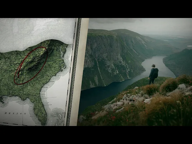
Appalachia's Hidden Arctic Landscape
Aidin Robbins
0:00 I want to tell you a story about two things
0:02 that I find more interesting than just about anything else.
0:06 The first is ice.
0:08 I love climbing on glaciers,
0:10 hiking through glacial landscapes, learning about ice ages.
0:14 And the second is home, the Southern Appalachian Mountains of North Carolina.
0:19 My earliest memories of the outdoors are visiting
0:22 my grandparents in Boone and heading up to Grandfather Mountain.
0:25 And as an adult, I've come to appreciate
0:27 these mountains for their unique ecosystems and exceptional biodiversity.
0:33 Unfortunately, my two muses have zero overlap.
0:38 There are no glaciers in the Appalachian Mountains,
0:41 and even during the peak of the last ice age,
0:43 when monstrous ice sheets covered much of North America,
0:47 the southern part of the range was completely free of ice.
0:52 But a few months ago, I stumbled across a study.
0:55 It was published in 1973 by two
0:58 geologists at Appalachian State University in Boone,
1:02 Jim Berkland and Loren Raymond.
1:04 They claim that a glacier existed on Grandfather Mountain during the Ice Age.
1:09 And they have evidence.
1:11 Parallel grooves carved into a rock outcrop.
1:14 Dozens of them, some up to a meter long.
1:17 I'm hiking up Grandfather Mountain,
1:19 trying to find some of these alleged glacial features.
1:23 A key feature of glaciers is that they move, slowly sliding downhill.
1:28 And as they move, they pluck rocks
1:30 from the surrounding mountains and drag them across the ground,
1:33 scraping out these parallel grooves.
1:36 They're a bunch of separate little rock outcrops,
1:39 and I have no idea which one actually has the scratches on it.
1:43 I think I'll be here for a while.
1:45 The grooves were found in this bowl-shaped valley on the side of the mountain.
1:49 It looks a heck of a lot like a glacial cirque,
1:52 these scoop-shaped valleys carved out by the ice.
1:55 We're at 1,400 meters facing south.
1:59 There's south.
2:00 This find is huge, and Berkland and Raymond know it.
2:04 That rock looks a lot like this rock.
2:08 They describe it as, quote, "100% incontrovertible," absolute evidence that will
2:13 force the revision of all geology textbooks.
2:18 My goodness.
2:19 They hold a press conference on top
2:21 of the mountain and bring reporters to the site.
2:23 I'm on the other side of the valley now because I have one more spot that maybe,
2:29 less likely, but maybe could be the spot.
2:31 Wait a second.
2:33 That is absolutely that rock.
2:35 Which means you should be right here.
2:41 (calming music) A few months later, three geologists from Ohio State
2:53 and the US Geological Survey publish a response.
2:56 They visited the site themselves and found
2:59 stains of iron oxide within the grooves.
3:02 Nearby, they found old metal cables matching the grooves width.
3:07 Well, well, well...
3:09 And they've interviewed a retired logger who worked in the valley in the 1930s,
3:14 operating a machine that used metal cables to transport logs down slope.
3:21 Yeah, they were wrong.
3:23 Still no glaciers in North Carolina, but it's okay to dream, you know?
3:30 John Hack, one of the responding authors, did admit that it was quote,
3:34 "surprising that we haven't found evidence
3:36 of glaciation in the southern Appalachians,
3:39 and that it would not be surprising if some hollows were occupied
3:42 by ice and glacial processes were active on a small scale." However,
3:48 if we're willing to zoom out and look at the entire Appalachian mountain range,
3:54 we do not have to dream about glaciers.
3:57 So let's go on a road trip.
4:00 We'll drive north to a landscape carved by glaciers.
4:04 We'll look for geological and fossil evidence of the ice.
4:08 And we'll see relics of the ice age still surviving today.
4:11 Small pockets of the vast tundra
4:14 and snowy forests that once blanketed this landscape.
4:18 We'll go looking for Appalachia's glaciers.
4:21 And we just might find them.
4:27 Last month, a group of scientists published
4:30 findings from this cave in the Norwegian Arctic,
4:33 just packed full of animal bones from the Ice Age.
4:37 It provided a very vivid look
4:39 at this Arctic ecosystem from about 75,000 years ago.
4:42 I found out about this story and was able to very
4:45 easily dive into it thanks to the sponsor of today's video.
4:49 Ground News is a website and an app
4:51 that aggregates news stories from all around the world.
4:55 It tells you about different outlets' political leanings,
4:57 their credibility and factuality, even who they're owned by.
5:01 Take this story from last month about
5:03 glacial flooding from the Mendenhall Glacier in Alaska.
5:06 It was covered by 257 sources,
5:09 most in the political center and not many leaning right.
5:12 Most sources on the right focus on the response to this individual event,
5:17 while left-leaning sources are more likely to frame it in a broader context,
5:21 a result of climate change requiring preparation
5:24 for similar events in the the future.
5:26 One really cool feature is blind spots,
5:29 which highlights stories disproportionately covered
5:32 by either side of the political aisle.
5:34 Stories you might otherwise miss entirely.
5:37 A recent study found that warming oceans could
5:40 significantly reduce populations of an important phytoplankton species,
5:44 threatening the entire marine food web.
5:46 This was covered by 44 sources, but only two that lean right.
5:50 This is actually a big part of what this video is about,
5:53 how connected this whole climate system is and how
5:56 changing temperatures can have all of these downstream effects.
5:59 All these tools that Ground News offers are helping me
6:02 to broaden the stories I'm consuming and stay informed on environmental,
6:06 science, and just general news.
6:09 Right now, Ground News is offering 40% off of their Vantage
6:12 plan using the link in the description of this video.
6:15 That's all of the tools we just talked about for just $5 a month.
6:19 The link is ground.news/Aidin, or you can scan the QR code on screen.
6:25 Thank you to Ground News for making this trip and this video possible,
6:29 and just helping me to stay informed.
6:32 All right, I'm a day in, I've made it up to Virginia,
6:35 and even just moving a little further north up here,
6:38 you find a feature that we really don't have down in North Carolina,
6:42 which is talus slopes, these big exposed boulder fields running down
6:48 the slopes of some of the mountains.
6:50 If you're looking for a glacier in the Southern Appalachians,
6:54 these might be your best bet.
6:59 Paraglacial features aren't created by glaciers directly,
7:02 but by the very cold climate near the ice sheets, often by snow, ice, or frost.
7:09 Talus slopes like this are found throughout the Central Appalachians,
7:12 and some geologists believe they could be the remains
7:15 of rock glaciers formed during the ice age.
7:19 Rock glaciers are a combination of rock and ice.
7:22 They can form when rockfall covers a regular glacier,
7:25 or in this case, when ice accumulates between the rocks.
7:30 The ice would lubricate this talus and allow it to slowly change shape,
7:35 and it would begin sliding downhill under its own weight.
7:39 Many of these talus slopes look a lot like
7:41 the rock glaciers found in paraglacial climates today, including this one.
7:46 It gradually narrows to a snout with a stream at the end, just like a glacier.
7:52 Many have been dated to the last ice age
7:54 and are made of rock from the mountains above,
7:56 suggesting that they have gradually moved downslope.
8:00 Rock glaciers in the Appalachians are certainly not a settled science,
8:05 and most publications emphasize that more research is
8:08 needed to confirm exactly what process formed them.
8:12 (gentle music) During the last ice age,
8:34 the land just south of the ice was largely a cold tundra home to mammoths,
8:40 mastodons, giant beavers, muskoxen, caribou,
8:44 dire wolves, saber-tooths, massive short-faced bears.
8:49 And this landscape extended south all
8:51 the way into the mountains of West Virginia.
8:55 I remember several years ago now learning about this place
8:58 in West Virginia that preserved a relic of ice age sub-Arctic tundra,
9:05 surviving on the top of this plateau.
9:08 Up here, it feels completely different
9:11 from the valley just like half a mile away.
9:13 Down there, it's like a nice, sunny, warm summer morning.
9:17 Up here, it's chilly, it's windy, it's foggy.
9:21 So after the ice sheets had retreated,
9:23 the tundra that covered most of this landscape was
9:26 gradually overtaken by the forest that you see now.
9:30 But up here, in this climate that's so different from the surroundings,
9:34 that tundra held on.
9:36 I mean, how cool is that, right?
9:37 You've got this big table up high in the middle of the mountains,
9:41 preserving this relic of ice age tundra, completely out of place.
9:46 It's biogeography at its absolute coolest.
9:52 Unfortunately, it's not quite true.
9:56 In 1746, surveyor Thomas Lewis led
9:59 the first European expedition onto this plateau.
10:03 His journal describes reaching the summit to find a clearing
10:06 a quarter mile wide covered with rocks and wetlands.
10:10 But for the most part,
10:11 he describes a tangled landscape of big trees and dark swamps.
10:16 This plateau supported one of the largest and best
10:19 developed spruce forests in the entire Appalachian range.
10:23 Massive trees sat on a thick floor of moss and decaying plants.
10:28 Although it wasn't a tundra, this was a relic from the ice age,
10:32 a boreal forest home to rare plants usually found much farther north.
10:37 The plateau's climate is similar to the boreal zone:
10:41 cold and windy, with frequent fog and frost all year.
10:45 Here we find some more paraglacial features:
10:48 patterned ground made by permafrost, and fossilized chunks of ice underground.
10:54 There were some tundra-like patches made up of ferns, shrubs, and stunted trees,
11:00 but there's debate over whether these open
11:02 spaces were made by the plateau's climate alone,
11:05 by natural wildfires, or by indigenous burning of the landscape for agriculture.
11:14 At the start of the 1900s, lumber mills opened,
11:18 railroads crossed the plateau, and loggers began clearing the spruce forest.
11:23 They described massive trees, a thick layer of moss covering forest floor,
11:28 and pockets of snow and ice lingering until the middle of summer.
11:32 By 1912, 85% of West Virginia's forests had been cleared,
11:38 and this plateau was left in a particularly degraded state.
11:42 Repeated wildfires burned large areas,
11:45 killing saplings and completely burning off the top soil in some areas.
11:50 The resulting landscape is one most trees can't tolerate.
11:54 Instead, it was recolonized by plants that can handle sun,
11:58 wind, snow, and extreme temperatures.
12:01 The result is essentially a man-made tundra.
12:06 It continues to provide a refuge
12:08 for ecosystems and species found much farther north,
12:11 including peat bogs and snowshoe hares.
12:28 I think I owe you an actual like relic ice age landscape, so this is just that.
12:35 It's a cranberry bog that's been here, well, since the last ice age.
12:40 This valley is at a decently high elevation,
12:42 but it's also surrounded on all sides by mountains,
12:45 which has created this very cool microclimate in the bottom here.
12:50 And it's allowed this ecosystem that only exists much further north,
12:54 much colder places, to persist here.
12:57 The surrounding mountains were of course, logged extensively,
13:00 but the wetland itself avoided most of the effects,
13:03 leaving it today as one of the largest and most intact in West Virginia.
13:08 It represents a time capsule of the high elevation
13:11 peat bogs that were widespread during the last ice age.
13:15 And it's similar to bogs found today in glaciated landscapes much farther north.
13:20 It's home to rare plants, invertebrates, and even mammals.
13:24 And it's the farthest south that many of these species can be found.
13:28 If you want kind of a time capsule of what a whole
13:30 bunch of this area would have looked like during the last ice age,
13:33 this is a pretty good example.
13:36 No strings attached.
13:39 (dramatic music) Welcome to maybe the last place I
14:22 would have expected making these videos to bring me.
14:25 We are in New York City.
14:28 Specifically Central Park, which believe it or not,
14:30 is absolutely dripping with glacial geology.
14:34 There are striated rocks, big parallel grooves,
14:38 and erratic boulders all over Central Park.
14:42 Some of the most striking features glaciers leave behind are boulders,
14:46 carried along on top of the ice and left behind when it melts.
14:51 They're often found in kind of strange places.
14:54 But these are not the city's only glacial features.
15:01 (train engine rumbling) Good morning from the edge
15:21 of the Hudson River here in New York,
15:24 which unbeknownst to me until working on this video, not really a river.
15:29 It's a glacial fjord.
15:30 Fjords are not common in the Northeast.
15:34 This is the only one in the Eastern United States,
15:37 but happens to run right through Manhattan.
15:41 Who knew?
15:41 Not me.
15:43 New York City sits right on the edge of the former ice sheet.
15:47 Here, a shelf of ice jutted out over the ocean.
15:50 Waves eroded the ice and broke off icebergs.
15:54 Small stretches of the coast remained free of ice
15:57 and acted as a refuge for plants and animals,
16:00 as did some of the highest mountain peaks,
16:03 poking out above the ice to form nunataks,
16:06 islands in the sky where species could escape the ocean of ice.
16:12 It is low tide here on the coast of New Hampshire.
16:17 I'm looking for trees, trees underneath this beach,
16:21 actually an entire forest underneath this beach.
16:25 During the last ice age,
16:26 sea levels were between 85 and 130 meters lower than they are today.
16:32 And North America was a lot bigger.
16:35 A land bridge connected Alaska to Siberia and massive
16:38 islands existed off the coast of New England, Nova Scotia, and Newfoundland,
16:43 providing a refuge for most of the plants and animals found in the region today.
16:48 As the ice melted, sea levels rose.
16:51 The land bridge closed, refugia were erased,
16:55 and the islands became shallow banks.
16:58 Today, they're hot spots for marine life and famous fisheries,
17:01 most notably the Grand Banks of Newfoundland.
17:06 On George's Bank off the coast of New Hampshire,
17:08 fishermen trawl the seafloor for scallops, clams, and fish,
17:12 accidentally recovering the teeth of mammoths and mastodons,
17:16 and helping scientists to understand what
17:19 this region looked like during the Ice Age.
17:22 Off the coast of Nova Scotia,
17:24 Sable Island preserves the last tiny remnant of these once massive islands,
17:30 home to relic populations of the plants and insects
17:33 that found refuge here thousands of years ago.
17:36 And between 3500 and 4000 years ago,
17:39 as sea levels rose, this forest in New Hampshire was submerged.
17:45 Its remains are preserved as sub-fossil tree stumps,
17:49 only above water when the tide is at its lowest.
18:10 Making a quick stop right off the road on the way into New Hampshire
18:14 here just to check out what looks like kind of a silly geological site.
18:22 This is the largest glacial boulder in North America.
18:32 New Hampshire's landscape is unapologetically glacial.
18:37 (uplifting music) I am beginning what I anticipate being a pretty
19:18 tough hike here in the White Mountains of New Hampshire.
19:21 It's going to be a decently long day,
19:23 but a day that should get us close to a lot of cool glacial stuff.
19:29 The White Mountains are most famous for their weather,
19:32 often regarded as the worst in the entire country.
19:36 The weather station at the summit has recorded 28 foot snow packs,
19:40 negative 47 degree Fahrenheit temperatures, winds over 200 miles an hour.
19:45 A couple of years back,
19:46 they recorded a negative 108 degree Fahrenheit wind chill,
19:50 the coldest ever recorded in the U.S.
19:52 and one of the coldest in the world.
19:55 All right, now that we've actually got some views,
19:57 you can see that this is an actual glacial cirque,
20:01 unlike the one in North Carolina.
20:03 This one's real.
20:04 You'll notice it looks like it was made using an ice cream scoop,
20:07 just right out of the side of the mountain.
20:10 Now the task is of course to climb up to the top up here.
20:16 So ways to go.
20:19 The White Mountains most famous cirque is the Tuckerman Ravine.
20:22 It's a deep valley right below the summit of Mount Washington,
20:26 allowing enormous amounts of snow and ice to accumulate and linger
20:30 later into the summer than anywhere else on the East Coast.
20:34 A few decades ago, the snow stayed nearly the entire year,
20:38 and meteorologists predicted that if the climate got just a little bit cooler,
20:42 then snow would begin to accumulate and a new glacier would form.
20:47 The winter of 1968 and '69 brought
20:50 a record 566 inches of snow to Mount Washington.
20:55 In April, newspapers reported snow depths between
20:58 100 and 200 feet within the Tuckerman Ravine,
21:02 and began predicting that it was on the verge of growing a new glacier.
21:07 For a few months, it really looked like
21:09 the Appalachians could have their very first glacier.
21:12 The Tuckerman Ravine Glacier didn't materialize,
21:15 but I was curious if anything like this had happened before.
21:20 Boston Evening Transcript, July 31st, 1879.
21:25 It is not generally known that we have a genuine glacier in the White Mountains.
21:31 The New York Tribune on July 31st, 1858,
21:34 describes a mass of snow as much as 100 feet deep,
21:38 compacting into ice as hard as marble under its own weight,
21:41 with small crevasses along its edges.
21:44 This one tells a story about a mountaineer getting,
21:47 quote, "lost in a glacier" in Tuckerman Ravine.
21:50 In July of 1879, astronomer and mountaineer
21:54 William Henry Pickering visits the Tuckerman Ravine.
21:57 He's heard about this mass of snow and ice
22:00 and wants to find out if it really is a glacier.
22:04 Reaching the valley, he describes a mass of ice,
22:06 a thousand feet long and a hundred feet deep,
22:09 narrowing to a point at the bottom, just like a glacier.
22:13 Remember, a key feature of glaciers is that they move.
22:17 So Pickering places a line of rocks across the snow and marks their position.
22:22 He returns three weeks later to find
22:24 that his rocks have moved 13 feet down slope,
22:27 a rate of eight inches a day, very normal rate for an alpine glacier.
22:33 I was even able to track down a few
22:35 photos of the Tuckerman Ravine from the 1800s,
22:38 and it certainly looks like a glacier.
22:41 But as we've seen, that doesn't necessarily mean that it is,
22:45 because the snow and ice in the Tuckerman Ravine
22:48 does eventually melt by the end of the summer.
22:51 In September, Pickering presents his findings to the Appalachian Mountain Club,
22:56 opening a debate on what does and doesn't count as a glacier.
23:00 The seasonal melting and reappearance causes a lot of people to object,
23:04 but the article concludes that, quote,
23:06 "the general conclusion seems to be that we have a baby glacier."
23:11 Baby glacier is one of many creative names used by the various papers.
23:16 The newspapers make the same inference as the ones from 1969,
23:21 that if it got just a little colder, this would grow into a proper glacier.
23:26 (wind rumbling) Well, I am up top now.
23:31 And honestly, that was tough.
23:33 That was honestly really hard.
23:35 Even harder than I expected, but beautiful.
23:38 Look at it.
23:40 In 1607, England established Jamestown in Virginia,
23:44 the first permanent colony in North America.
23:47 The same year, they established a second colony at Sagadahoc in Maine,
23:52 which failed within a year,
23:54 thanks largely to one of the most severe winters of the colonial period.
23:58 The English colonization of New England took place
24:01 right in the middle of the Little Ice Age,
24:04 a period of global cooling lasting from the 1300s to the mid-1800s,
24:09 and most severe between 1550 and 1700.
24:14 Crops failed, famines tanked local populations, and humans migrated,
24:19 with the Norse abandoning Greenland and the Inuit expanding south,
24:24 some reaching Scotland.
24:26 In the New England colonies,
24:27 mills and government offices had to shut down during the winter months.
24:31 Crop shortages starved livestock and forced colonies to import food.
24:37 Many of these first colonists believed they had
24:39 a divine responsibility to reshape North America's environment,
24:44 including its climate.
24:46 Explorer and colonial governor John Smith claimed that as settlement progressed,
24:50 cold New England would become warm and lush.
24:54 Even in Newfoundland, colonial governor Richard Whitbourne wrote
24:57 that European settlement would warm the island.
25:01 North America's first colonists truly believed
25:05 that they could change the climate.
25:10 It's July, and there isn't a speck of snow in the Tuckerman Ravine.
25:24 The Appalachian Trail ends in Maine, but the Appalachian Mountains don't.
25:29 They actually extend all the way up to the Canadian island of Newfoundland.
25:34 Doesn't get much more glacial than that, right?
25:36 as a Fjord with a capital F.
25:39 Ironically, it's technically not a Fjord because
25:41 it doesn't quite connect to the ocean, but come on, look at it.
25:44 It's a Fjord.
25:47 Here, the ice age is ongoing.
25:50 The subarctic tundra and boreal spruce forests are still extensive,
25:55 home to caribou, lynx, arctic foxes.
25:58 Occasionally, polar bears wander over on the spring sea ice.
26:03 Across the Labrador Sea is Greenland,
26:05 still almost entirely buried under glaciers.
26:09 Pieces of Greenland's coast remain free of ice
26:11 and act as a refuge for plants and animals,
26:15 as do some of the highest mountain peaks.
26:18 A shelf of ice juts out over the ocean.
26:21 Waves erode the ice and break off icebergs.
26:26 The Labrador current carries them south, and in the spring they end up here,
26:30 stranded in the shallow waters off Newfoundland's coast.
26:36 This was the last place in North
26:38 America that humans reached after crossing from Eurasia,
26:41 and the first place Europeans reached:
26:44 Vikings in the 11th century and cod fishermen in the 15th.
26:50 The Grand Banks became one of the world's most lucrative fisheries,
26:54 supporting the island's economy for centuries.
26:57 But by the 1980s, overfishing had depleted the cod, and in 1992,
27:02 the federal government put a moratorium on cod fishing in Newfoundland,
27:07 almost entirely shutting down the fishery.
27:11 Now, the best bet for keeping the island's economy afloat seems to be tourism,
27:16 and the icebergs are one of its biggest draws.
27:21 Newfoundland's landscape and archeological sites tell a story about
27:25 climate migration at one of history's most overlooked crossroads.
27:30 About unique species and cultures that have been erased.
27:34 About what the ice means for our own species.
27:39 It's a story that I've chosen to make into a second video,
27:42 so keep your eyes peeled for that very soon.
27:46 For now, I'll stick to trees.
27:50 I first visited Newfoundland a few years ago to make a video about icebergs.
27:54 I didn't know much of anything about glaciers or ice ages,
27:59 but I remember walking through the forests here
28:01 in Newfoundland and feeling that they were very familiar.
28:05 I saw familiar trees like the red spruce.
28:08 I saw familiar ferns and plants on the forest floor.
28:12 The forest here is strikingly similar to the forests I'd
28:17 seen hiking in the mountains back home in North Carolina.
28:20 Of course, here in Newfoundland, you find this forest right on the coast,
28:23 and back home they only grow on the tops of the highest mountains.
28:27 But still, I remember this feeling of being almost 2,000 miles away from home
28:32 in this place that is a world
28:34 apart from the Southern Appalachians in every sense.
28:39 But it felt like home.
28:42 At the top of Mount Washington and a few adjacent peaks,
28:45 you'll find an ecosystem that doesn't look too different from Newfoundland.
28:50 As the ice retreated and the climate warmed,
28:52 the tundra climbed higher into the mountains to find a colder climate.
28:57 And today, a handful of the highest peaks
28:59 in New England preserve small pockets of alpine tundra.
29:03 These mountaintops are home to butterflies found nowhere else.
29:08 Living only in cold climates, they followed the tundra up to the summits.
29:12 where they've since become trapped and evolved into distinct species.
29:17 All right, check this out.
29:18 This is one of the last remaining old-growth spruce forests in West Virginia.
29:24 Despite the extensive logging in West Virginia,
29:28 this is a spot they missed, and it is gorgeous.
29:31 And although it is much reduced from what it was a couple hundred years ago,
29:35 this is actually still the most extensive spruce forest south of New York.
29:41 This is also the habitat of the Cheat Mountain salamander.
29:44 Called that because it pretty much only lives
29:47 on Cheat Mountain and a few of the surrounding peaks.
29:51 All right, I found one.
29:52 I'm not positive, but I think he's a Cheat Mountain salamander.
29:55 He looks like one.
29:57 These are federally listed as threatened because their habitat is so restricted.
30:01 They only live in these high elevation spruce forests,
30:05 pretty much just on this one mountain and a few peaks around it.
30:09 So it's cool to find one.
30:13 These talus slopes are also the habitat of the endangered Shenandoah salamander.
30:19 It lives on just a few of the highest peaks here in Shenandoah National Park.
30:24 So it has one of the most isolated ranges of honestly, like any species.
30:30 And it survives by living in the damp, dark,
30:34 cool, microclimate underneath the rocks on the slopes here.
30:39 This is, I think, a Shenandoah salamander.
30:43 It certainly looks like one.
30:45 It's crazy that these have such an isolated range.
30:47 I'm on one of three mountains you can find these on, like
30:50 three of the highest peaks in this region, and that's it.
30:57 Super cool.
30:59 During the Ice Age, Boreal Spruce forests blanketed the Southern Appalachians.
31:05 As the ice retreated and the climate warmed, they climbed upward.
31:09 Look at a map of the red spruce's range
31:12 and you'll see dozens of islands dotting the highest peaks.
31:16 Every single one is a relic of the ice age.
31:20 I think they look like footprints left behind by the retreating ice.
31:25 Salamanders thrive in this cool and moist habitat.
31:28 So they followed behind,
31:30 many eventually becoming stranded on the region's highest
31:33 peaks and evolving into a host of different species.
31:37 Today, the Southern Appalachians are home to more
31:40 salamander species than anywhere else in the world.
31:43 Dozens are found only here, and new species continue to survive.
31:49 This was the refuge where so many of North America's species survived the ice.
31:56 Many have stuck around.
31:57 They've fragmented, evolved, speciated.
32:01 And today, the Southern Appalachians are one
32:03 of the most biodiverse temperate regions in the entire world.
32:08 The Ice Age is everywhere.
32:10 It is in the agricultural soils of the Midwest,
32:13 the abundant freshwater of the Great Lakes,
32:16 and the ranges of North America's animals.
32:19 It has left behind pieces of tundra on the shore
32:22 of Lake Superior and mountaintop forests in the Arizona desert.
32:25 It is in Newfoundland.
32:27 It is in New York City.
32:28 It is right in my backyard.
32:33 Driving back home these footprints of the ice look more like a line of dominoes.
32:38 Lose the ice and you also lose the icebergs, the white mountains tundra,
32:43 the butterflies, the peat bogs,
32:45 the sky islands, the salamanders, the biodiversity.
32:49 Lose the ice and you cut the thread tying this entire mountain range together.
32:57 Wow.
33:00 The glacier on Grandfather Mountain never existed.
33:04 But to say that this landscape was not made by ice...
33:13 I'm not convinced.