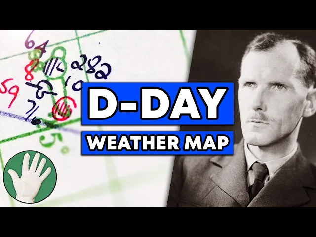
The D-Day Weather Map - Objectivity 297
Objectivity
0:00 Hi there everyone.
0:00 Welcome to the Met office here in the UK.
0:03 This is the weather and climate service for the entire country.
0:06 Full of weather maps here in the archive.
0:08 But today, Katherine Ross, the head of the archive here, is going to show us,
0:13 I'm going to say it, the most important weather map in all of history.
0:19 Ever.
0:22 Do you believe me?
0:23 Let's go and have a look.
0:25 I believe you.
0:26 You believe me?
0:27 Well, you think it is.
0:28 Here we go.
0:30 Massive spoiler, James.
0:31 Look at this.
0:33 So, here we go.
0:34 Here is a map.
0:35 Clearly, we can see Europe.
0:38 We can see the UK.
0:40 We can see Britain.
0:42 We can see the Atlantic Ocean.
0:43 We can even see Iceland and Greenland.
0:45 So, this is Europe.
0:46 And if you haven't figured out already, these maps are all about D-Day.
0:51 Do you think everyone knows what D-Day is?
0:53 Well, if they don't, D-Day was 6th of June, 1944.
0:58 And it was when the Allied forces landed on the beaches in Normandy
1:03 and France to basically start the fight back in World War II.
1:07 This was the turning point of World War II.
1:09 This was kind of the counter offensive when the Allies
1:12 went back into Europe and took on the Nazis.
1:15 Tell me about how these maps fit into the story and why they're so important.
1:20 It's the largest seaborn invasion in history.
1:23 Um, you can have all the stars aligned.
1:25 Everything can be perfect.
1:27 If you haven't got the right weather, you're not invading.
1:30 Speaking of the stars aligning though, the moon was a factor here, wasn't it?
1:33 Yeah.
1:34 Moon and tide had to be right.
1:35 Yeah.
1:36 So, that only gives you a certain number of days you can choose from.
1:39 Then the weather's got to be right as well.
1:42 So, the odds were more than stacked against them.
1:44 And the plan was to invade on the 5th of June.
1:47 Everything was ready.
1:48 Only one problem.
1:49 The weather wasn't good enough.
1:51 Okay.
1:51 Okay.
1:51 And so this chart is for the 5th of June.
1:53 We can see it up here.
1:54 It says Air Ministry Meteorological Office, Monday 5th of June, 1944.
2:00 And this forecast is basically, well, I don't know.
2:03 To me, it's just a bunch of numbers and squiggles and lines,
2:05 but this was no good.
2:06 In order to decide whether you're going to invade on the 5th,
2:09 you've got to make that decision on the fourth.
2:11 So on the fourth, they're looking at their observations and they're forecasting,
2:15 we don't think the weather's going to be good enough on the fifth.
2:18 So this chart shows us they got that.
2:20 absolutely bang on right.
2:22 So this isn't the forecast.
2:23 No, this is actual observation.
2:25 This is what actually happened.
2:26 And it turns out they were right.
2:28 The weather was rubbish.
2:29 So this blue line here is a cold front.
2:31 Fronts bring rain, wind, cloudy conditions,
2:36 all the things you don't really want.
2:37 And it would have been very choppy at sea.
2:39 The gliders wouldn't have been able to fly over.
2:41 No airborne operations possible.
2:44 So you know, totally impossible to invade basically.
2:47 So this is Normandy where they landed and they
2:49 would have been starting from all across here.
2:52 Yeah.
2:52 All all the way along this side of the south coast.
2:55 So I mean what you can see from here,
2:57 not just this this macking great weather front.
2:59 These are called station symbols.
3:01 So they show us the observations at weather stations.
3:04 And probably one of the key things you can pick out is in these circles.
3:07 They draw how much cloud there is.
3:09 So basically the more lines then you've got full cloud.
3:12 So it's completely cloudy here.
3:14 It's completely cloudy here.
3:15 It's completely cloudy over here in the channel and the isobars here.
3:19 So these tell us the direction of the wind.
3:21 Wind will go down these lines.
3:23 But the closer they are together, the stronger the wind is.
3:26 So you can see these isobars are in our opinion quite tight.
3:29 This this means it's windy.
3:30 This sort of thing over here where they're further apart means lighter winds.
3:34 Okay, we've gone back.
3:36 We've gone back in time.
3:36 We've gone to the 4th of June,
3:38 the day before what would have been D-Day but wasn't D-Day.
3:41 Um, okay.
3:42 So this was the this was the weather
3:44 the day before planned D-Day 2 days before actual D-Day.
3:48 So what happens when you're doing synoptic weather
3:50 forecasting which is what was happening here before computers.
3:53 So you take your observations and then about every
3:56 1 hour actually at the when it's really really important
3:59 you take them again and you plot them again
4:00 and then you can see how your weather fronts are moving.
4:03 You can see how the weather patterns are moving.
4:05 So the forecasters would have been looking at this.
4:08 Yep.
4:08 On the fourth.
4:09 On the fourth and going that's going to be here tomorrow.
4:12 So the plan to go on the 5th.
4:14 They're saying no don't do it.
4:15 Who actually is doing this?
4:16 Who's got this massive responsibility?
4:19 So there's a guy called James Stag, group captain James Stag.
4:22 He was a meteorologist.
4:23 He was given rank basically so that he
4:25 could talk to Eisenhower and the joint chiefs.
4:28 So he was the lead meteorologist.
4:30 He was working with a team.
4:32 So he was working with um American milit meteorologists,
4:35 UK meteorologists and they all had to try
4:38 and agree on whether they think the weather's going
4:40 to be good enough and then he stag
4:42 would then take that decision or make that decision.
4:45 If nobody could actually agree, he had to take final responsibility
4:49 and then take that to Eisenhower, General Eisenhower.
4:52 He says we go or we don't go.
4:54 Have we ever heard from Stag
4:57 as to how heavily that responsibility weighed on him?
5:00 Yeah, we've got his diary actually.
5:02 Okay, we've popped upstairs now for a quick look at the stag diary.
5:05 This is amazing.
5:07 Have a look at the front diary 1944.
5:10 D-Day diary historic document keep HM stationary office.
5:15 I love all this stuff.
5:16 Here are the big days in question.
5:18 June 3, June 4, June 5.
5:21 Let's have a look at June 4,
5:22 the day before what was going to be D-Day until they called it off.
5:27 Yes.
5:27 So this is stag chief forecaster you desperately
5:30 trying to find a solution in that weather
5:32 and he says I am now getting rather stunned it is all a nightmare right
5:37 the pressure's on so he wrote that diary on the day he was looking
5:40 at this very map and going am I can we do this can't we do this okay
5:45 so he said don't go on the fifth don't go on the fifth so when
5:48 we look at the map for the fifth he's vindicated there's this front as you
5:52 told us it would have been horrendous if they had done D-Day luckily they didn't
5:56 but he's now looking at this and got to decide can we go on the sixth.
5:59 Yeah.
6:00 And moon and tide are only right on those few days.
6:03 You can't push it over to the seventh.
6:04 It's you know the moon and tide are wrong.
6:05 So he's it's it's we go or we don't go in the next 24 hours.
6:09 I'm getting chills just thinking about it.
6:10 As I say, it was really marginal.
6:12 Not everybody agreed on this.
6:14 So he's looking at this.
6:15 We got it right.
6:16 Then he's looking here and he's looking at this thing
6:19 with an H in the middle of it.
6:20 H means high pressure.
6:22 This is sitting out over the Atlantic.
6:23 How is he getting measurements from the Atlantic Ocean?
6:26 I see there are stations here.
6:27 There's not land here, is there?
6:29 No.
6:29 So, these will be ships.
6:30 I There's the odd island out here as well,
6:32 but certainly these are all ship observations,
6:35 but there's still a few Ubot around at this time.
6:38 So, obviously, if you break radio silence,
6:40 then you know, you're potentially asking to be torpedoed.
6:43 So, this isn't something they would have done ordinarily all the time,
6:46 but they will have received essentially a code of message saying,
6:48 "We need your observations." Because they're looking
6:51 to see that low pressure coming in.
6:52 Yeah, it's coming.
6:53 Yeah, we've got a problem.
6:54 Now, they're looking for high pressure.
6:55 Can we see the high pressure coming in?
6:57 Are things looking better?
6:58 They think is this going to be the savior and push away?
7:01 Yeah, absolutely.
7:02 Obviously, we all know what the call was go.
7:05 But was it was it given with any qualification?
7:07 Was it go but don't blame me if it rains or was it how like do we know anything?
7:12 Kind kind of.
7:13 And now we go to Monday, June 5th.
7:16 This is where he makes the call.
7:18 What have we got?
7:19 What's what's being said?
7:20 Yeah.
7:20 So, fair interval confirmed.
7:22 We've decided we've got it.
7:23 An invasion put on.
7:25 final and irrevocable decision.
7:27 Whatever the outcome, the decision is taken.
7:30 Here we have a bit about the congratulations and he's having some doubts.
7:33 What's what's what does he say?
7:34 Yes.
7:34 So yeah, he he has got some some doubts.
7:36 He knows it's marginal.
7:37 So you got Admiral Cesy here and Admiral Cesy
7:39 said you should be proud of yourself and your forecast.
7:43 And then Stag's response is I wonder he should wait till he sees how things go.
7:49 All right.
7:51 Now the next map shows us what what actually happened.
7:54 Here we go.
7:55 Here is the 6th of June.
7:57 Dday itself.
7:58 Dday.
7:59 Yeah.
7:59 This is a high here.
8:01 I don't see any blue lines or That's all the way over here now.
8:04 So that's well out the way.
8:05 Here's the blue line here.
8:06 There's the front.
8:07 It's moved across Europe giving reasonable weather.
8:11 I believe reasonable but borderline.
8:13 So here's the high pressure, but what they wanted that pressure to be was here.
8:18 So here's your nice widely spaced isobars with your light winds.
8:22 They aren't here.
8:23 These are although not as tight as they were yesterday,
8:27 you know, these are still reasonably tight isobars.
8:30 So, it was still quite windy.
8:31 It was choppy, you know,
8:32 and you can still see here we've still got some cloud symbols across the coast.
8:37 The black lines there pointing down in the little circles there.
8:40 That's what you're after.
8:41 The red lines show you how cloudy it was in the last hour.
8:43 So, it was still cloudy, but if you have a look at this one down over Normandy,
8:48 you can see there's only one line in that circle.
8:50 So, not crazy cloudy,
8:52 which is why the the airborne operations were able to take place.
8:56 It wasn't perfect, but it was just about Well, here's the question then.
9:00 Obviously, D-Day was a horrendous event, but ultimately,
9:04 I guess you'd have to call it successful.
9:06 You know, it turned the war.
9:08 Did Stag get it right?
9:09 Like, should they have gone that day?
9:11 How does weather history judge this call?
9:14 So weather history judges correctly in my opinion this as the most
9:18 important forecast the Met Office has ever made and a correct forecast.
9:21 It was correct.
9:22 It was it was correct.
9:24 It was marginal but it was the right side of marginal.
9:27 It was good enough.
9:28 One of the things that really helps us with that um
9:31 is that you know it wasn't just that the allies had forecasters,
9:34 the Germans had forecasters too.
9:36 Right.
9:36 And so their weather forecasters had the job
9:38 of predicting what the British forecasters were predicting.
9:42 Correct.
9:42 Yeah.
9:43 is an available to them.
9:49 Okay, so this isn't an original, is it?
9:51 This is the German map for what the same time or so it's almost the same time.
9:57 It's not quite, but um but this is a German map.
9:59 Again, you can see the the cold front.
10:01 Not quite in the same place as we've got it, but well out the way,
10:04 but what you can see here by comparison with here,
10:08 if we just line these up, that's the UK.
10:10 Yeah, that's the UK.
10:12 We've got loads of observations all over the UK.
10:14 They've got none or virtually none.
10:16 And where's the Atlantic?
10:18 They don't know about this high pressure.
10:20 Exactly.
10:20 They don't know about the high pressure.
10:22 So they advised that it wouldn't be possible
10:24 to invade if we'd been looking at glorious conditions.
10:27 A nice high pressure plonked right there, therefore right here.
10:32 They'd have known just as well as we
10:33 did that it was perfectly possible to invade.
10:35 Another thing, Katherine, that's really noticeable is, as you said,
10:38 no weather observations for the Germans, for Britain, or virtually none.
10:42 But the British are getting observations from Europe,
10:46 presumably parts of Europe that are even occupied.
10:48 Yeah, most of that.
10:49 How are they getting that?
10:50 Obviously, the British or the Allies had cracked the Enigma code.
10:53 So, they're reading all of the German radio traffic
10:56 and whether observations were part of that radio traffic.
10:59 So the British sitting up in Bletchley Park are picking it all up, decoding it,
11:03 and then the Allies are able to plot all of that data onto their maps.
11:07 So it kind of comes down to a war of data, and the Allies had more.
11:10 I tell you who I think some real unsung heroes are.
11:14 The people who were sending in these forecasts
11:16 out at the Atlantic that the Germans didn't have.
11:19 They're breaking radio silence.
11:20 They could get torpedoed.
11:21 And that's the data that decides it, isn't it?
11:24 Yep.
11:24 That really helps us to know that, you know, there's a high pressure moving in.
11:28 Do you know what though?
11:29 This one here for the sixth is like the glamour map cuz it's D-Day.
11:33 But the real important map is the day before.
11:36 That's the map.
11:37 So this is often referred to as the D-Day map because it's D-Day.
11:41 But when we're telling the story, we always say really this is the D-Day map cuz
11:47 this is what they use to be able to make that decision.
11:50 So this is 1:00 in the morning and the conference where
11:53 they decided to go or no go was 3:00 in the morning.
11:56 And this is the actual map.
11:57 They would have been touching this one
11:59 and looking at this one and using this one.
12:00 Some of them would have been.
12:01 I mean, there'd have been a few copies of this around,
12:03 but yes, certainly some of the forecasters would have been using this.
12:07 Wow.
12:08 Well, I feel really lucky to get to see an actual copy like this.
12:12 It's uh Yeah, you feel you feel the weight of history when you look at it.
12:18 The thing I'm wondering is what's written for D-Day itself.
12:20 Let's turn the page and go to the 6th of June.
12:23 Not a lot.
12:24 No.
12:24 No.
12:25 Why not?
12:25 What?
12:26 What?
12:26 What?
12:26 His job's done, you know, for for you know, they're on the beaches.
12:30 You know, it's it's done.
12:31 Portsouth is where the decision is made.
12:32 So, he goes back from Portsmouth up to London.
12:35 Return from Portsouth.
12:36 You know, lunch at home by 2:30.
12:38 You know, I mean, he does mention some
12:40 concern about the weather because the cloud becomes 10/10,
12:43 which is full cloud cover, and the wind increases.
12:45 So, you know, caused me considerable worry at home,
12:48 but really too tired to be much concerned.
12:51 I mean, he's been up for the last 3 days.
12:53 This is really interesting.
12:54 He's He's having lunch at home back at home
12:56 at 2:30 while the while this is all still happening.
12:59 Absolutely.
13:00 Yes.
13:00 And it's on his mind, but he's also just completely shattered.
13:03 He's exhausted.
13:04 Yeah.
13:04 And he knows there's nothing he can do.
13:06 You know, it's it it works or it doesn't work, but it's out of his hands now.
13:10 This is amazing.
13:11 What a great thing to have.
13:12 It is amazing.
13:12 I'm going to give it back.
13:13 And don't forget, I'll keep it.
13:15 Keep it.
13:15 All right.
13:18 Did you know you can support Objectivity on Patreon and get access
13:21 to all sorts of cool extra stuff
13:24 like high-res pictures of objects and documents,
13:28 bonus videos from behind the scenes,
13:30 and even your name here at the end of the video.
13:34 Check out the description and all the usual places
13:36 for a link to our Patreon page or go to patreon.com/objectivity.
13:42 It helps us get out there and make even more videos for you to watch.
13:46 Little bit of sun, little bit of sun, cloudy again.
13:49 And you can see here, Louisiana, at the end of the day,
13:51 they actually add up how much has been burnt
13:54 to tell how much sunshine there was that day.
13:56 Exactly.
13:56 So, 5.6 hours.