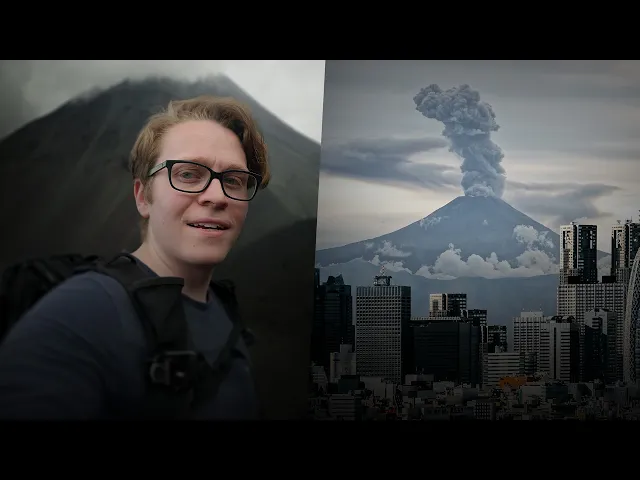
What if Mount Fuji Erupts Tomorrow?
Aidin Robbins
0:00 This might just be the most iconic mountain on the entire planet.
0:04 At 3,776 meters, it is Japan's highest peak.
0:10 It's a national park and a UNESCO World heritage site.
0:13 The mountain is mentioned in Japan's oldest stories, poems, and haikus,
0:18 and has been depicted thousands of times in Japanese art.
0:22 Both Shinto and Buddhism consider it a sacred home of the gods.
0:26 And for nearly a thousand years, observers have made pilgrimages to the summit.
0:31 They've built temples and shrines and marked the first climbing routes.
0:35 Today, more than 300,000 people follow these routes to the summit each year,
0:40 while millions more visit the mountain's lower slopes.
0:44 Fuji is a volcano.
0:46 It's erupted about 180 times in the last 5,600 years,
0:51 averaging once every few decades.
0:55 For the last 319 years, Fuji has been quiet.
1:01 The cities in its shadow haven't.
1:04 Tokyo has grown into one of the largest cities in the entire world,
1:08 more than 30 million people.
1:10 The edge of the city is just 50 kilometers from the volcano.
1:14 These are hazard maps showing how far lava,
1:18 lava bombs, pyroclastic flows, and volcanic mudflows could reach.
1:23 This one is the scariest, showing how far away ash could fall.
1:28 We'll look at these in more detail later on.
1:31 Fuji is just one of more than a hundred volcanoes in Japan.
1:35 Volcanoes are usually found along tectonic plate boundaries,
1:39 and this is the intersection of six different plates.
1:43 This is one of the most environmentally hazardous places on the planet.
1:47 Japan has some of the world's biggest earthquakes and tsunamis.
1:51 monsoons and typhoons cause flash floods and mudslides in the mountains,
1:56 and yet more than 120 million people live here.
2:01 Check out this graph of disaster-related fatalities in Japan
2:05 with two huge earthquakes in 1995 and 2011.
2:10 Notice how, at the start, there's consistently thousands of fatalities a year,
2:15 and then, around 1960, that drops to just a couple hundred.
2:19 Japan has led the world in figuring out how to mitigate disasters,
2:25 typhoons, floods, earthquakes, tsunamis, and even volcanic eruptions.
2:31 I wanna talk about what Fuji's next eruption could mean for Tokyo,
2:36 but I also wanna introduce you to volcanoes
2:38 that are even larger and much more active, one is erupting currently.
2:44 Every single one has people living concerningly close.
2:48 We'll learn about how people manage to live right in their shadows.
2:52 And perhaps more importantly, why?
2:57 (gentle music) Check this out.
3:20 This is Aso.
3:22 This is Japan's largest volcano and one of its most active.
3:26 On top of the crater rim here,
3:28 there's all these little concrete shelters, so you can,
3:32 I guess, hide out so a lava bomb or something doesn't fall on you.
3:35 What's nuts about Aso is that it's not just
3:38 that steaming cauldron over the edge of this crater.
3:42 It's this whole area.
3:43 These distant mountains back here, that's the edge of the caldera.
3:48 One of the country's most active volcanoes, very scary-looking at the top,
3:52 but still has thousands of people living within the crater, but that's Japan.
4:00 I have quite a few volcanoes to show you here,
4:03 and this is just the first of three videos from Japan.
4:07 This was a big trip.
4:08 It took an entire month to film everything.
4:11 Spending a month abroad is quite expensive, including phone service.
4:16 In the past, I've just used roaming data for $10 a day,
4:21 which adds up really quickly.
4:23 So I am very excited about the sponsor of today's video, Saily.
4:29 Saily is an eSIM service.
4:31 Just download the app, find the right plan for your trip.
4:34 Use the code Aidin at checkout for $3 off,
4:37 and now you can stay connected to the internet while you're traveling.
4:41 There's no need to go find a SIM card or pay crazy roaming fees.
4:45 My total is $9.34 cents for 30 days,
4:49 less than one day of roaming data would've been.
4:52 They have plans available for more than 200 destinations,
4:55 almost anywhere in the world.
4:57 And if you're visiting multiple countries,
4:59 you can get a regional or global plan.
5:02 They even offer an ultra plan with unlimited data and some extra travel perks,
5:07 like airport lounge access, fast track services, and online security tools.
5:12 SIM card is compatible with all iOS and Android devices,
5:15 so you can use the QR code on screen to sign
5:18 up and use the code Aidin for a $3 credit.
5:21 You can also share that code with friends and family
5:24 to stack up more credits for your future trips.
5:27 It's thanks to sponsors like Saily that big
5:29 trips like this are even remotely doable.
5:32 So thank you again to Saily for making this trip and this video
5:36 possible and just providing a service
5:38 that makes traveling smoother and more affordable.
5:48 Fuji is, obviously, Japan's most iconic mountain, that perfect cone shape,
5:56 but if you look at it from the right angle, you'll notice there's this big bite,
6:01 just this chomp taken right out of the side of the mountain.
6:05 October 28th, 1707, a magnitude 8.6 earthquake strikes Japan,
6:11 generating a tsunami that kills over 5,000 people.
6:15 At the start of December, smaller earthquakes are felt around Fuji.
6:19 On December 16th, a cloud of ash rises 20
6:22 kilometers above the summit and pumice falls from the sky.
6:27 By the end of the day,
6:28 falling lava bombs have burned temples and villages on the volcano slopes,
6:38 I'm inside of the chop.
6:43 The eruption lasted 16 days and released about 800 million cubic meters of ash.
6:49 The worst ashfall disaster in Japan's history.
6:53 About a million people lived in what is now Tokyo,
6:57 nearly four centimeters of ash and debris fell across the city,
7:01 blocking out the sun and causing respiratory illness.
7:04 Some parts of the city received as much as 15 centimeters,
7:08 accumulating on rooftops and eventually caving them in.
7:12 Farms near the volcano were buried under as much as three meters of ash.
7:17 Crops failed and a decade of famine followed.
7:21 During heavy rains, ash washed into rivers, forming volcanic mudflows,
7:26 fast-moving walls of ash and debris,
7:28 destroying farms and villages in their path.
7:32 Because the eruption left behind so much ash,
7:34 mudflows continued for nearly 200 years.
7:38 And in the worst affected areas, farmland is still unusable today.
7:46 The eruption came outta Fuji's south flank rather than its summit,
7:51 forming this crater.
7:52 (gentle music) Volcanic eruptions almost always begin with earthquakes,
8:12 and the earthquakes are almost always caused by the volcano.
8:16 Fuji 1707 eruption is a very rare case
8:20 where geologists believe the earthquake actually caused the eruption,
8:25 essentially plugging the magma chamber and allowing pressure to build.
8:32 In 1707, Japan was almost completely isolated from the rest of the world.
8:38 Sailing into the open ocean or even building
8:41 a ship capable of doing so was banned,
8:44 but small boats were often swept out to sea by storms or ocean currents.
8:49 Some returned with reports of a large white column rising from the sea,
8:54 a small island absolutely crawling with white birds.
9:03 (birds chirping and squawking) Fuji is the product
9:14 of the Pacific plate sliding beneath the Philippine plate.
9:19 Follow that plate boundary into the ocean
9:21 and you'll find a chain of volcanic islands.
9:26 Miyake Island is one of Japan's most active volcanoes,
9:30 erupting once every 20 or so years.
9:33 In 1983, lava flows destroyed forests and villages.
9:37 And in 2000, a large crater formed at the summit
9:40 and began emitting dangerous amounts of sulfur dioxide.
9:44 The entire island was evacuated and residents couldn't return until 2005.
9:50 Today, those on the island are required to carry
9:53 gas masks in case the volcano's sulfur emissions spike.
9:57 In the mid 1800s, Japan's isolation ended.
10:00 Explorers began sailing to distant islands, including Torishima,
10:05 a small volcanic island 500 kilometers south of Tokyo,
10:10 and the most important breeding ground for the short-tailed albatross.
10:14 In 1887, a Japanese businessman founded
10:17 the Tamaoki Company to harvest feathers from Torishima.
10:21 And by 1900, 300 people lived in a company town on the island.
10:27 Workers hunted more than a hundred birds a day.
10:29 And by 1902, more than 500 million had been killed.
10:34 That same year, the volcano erupted,
10:36 burying the town and all of its inhabitants.
10:40 Tamaoki himself was away,
10:42 so he returned and rebuilt the town and the business the next year.
10:48 in 1922, with albatross populations too low
10:51 to sustain the business, the company closed.
10:54 And in 1933, with fewer than a hundred left, hunting was banned.
11:00 Eruptions in 1939 and 1941, once again, buried much of the island under lava.
11:13 (horn blaring) In November of 1791,
11:41 a swarm of earthquakes was felt in the coastal town
11:45 of Shimabara at the foot of the Unzen Volcano in southern Japan.
11:50 In January, a column of ash rose from the summit.
11:54 And in February, lava began flowing down its slopes.
11:58 On May 21st, a large section of the mountain collapsed.
12:02 The resulting landslide swept much of Shimabara into the bay,
12:06 creating a tsunami that hit the city across the water.
12:10 15,000 people were killed in Japan's deadliest volcanic eruption on record.
12:17 The debris from the landslide can be seen today.
12:21 It added about four square kilometers to the coast and dozens of small islands.
12:34 In 1989, earthquakes were once again recorded near Shimabara.
12:41 (gentle music) An unstable lava dome grew at the summit,
12:54 reaching more than 120 meters tall.
12:58 Pieces of the dome broke off, sending pyroclastic flows down the volcano slopes,
13:04 fast-moving avalanches of extremely hot ash, gas, and debris.
13:10 (volcano rumbling) On June 23rd,
13:19 an unusually large pyroclastic flow killed 43 people,
13:24 most of them scientists and news reporters, including Katia and Maurice Krafft,
13:31 the world's most famous volcanologist at the time, and probably still today.
13:39 Over the next several years,
13:41 more than 9,000 pyroclastic flows reached further down the volcano slopes,
13:46 blocking roads and destroying homes.
13:53 This is a school right at the base
13:55 of the volcano here that was burned by pyroclastic flows.
13:59 It's been left in its mostly original state, hasn't really been cleaned up.
14:05 (gentle pensive music) (gentle pensive music continues) (birds
14:48 chirping) Sakurajima is widely considered Japan's most active volcano.
15:18 Look at it on a map,
15:20 you'll see this big island rising right out of Kagoshima Bay,
15:23 several craters at the summit, river channels running down its slopes,
15:28 and villages on the island, home to more than 4,000 people.
15:35 Just four kilometers across the bay,
15:36 you'll see Kagoshima City, home to more than 600,000.
15:41 January 12th, 1914, Sakurajima erupts, pyroclastic flows bury three villages,
15:49 and a magnitude seven earthquake kills 35 people in Kagoshima City.
15:54 Over the next few weeks,
15:55 lava flows bury five more villages and one connects the island to the mainland.
16:01 By the time the eruption ends,
16:03 half of the more than 20,000 people living on the volcano have left for good.
16:09 Smaller eruptions happened in 1939 and 1946.
16:13 And in 1955, Sakurajima began erupting almost nonstop.
16:19 In 1985, 474 eruptions were recorded at the summit.
16:24 In 2009, activity increased again, reaching nearly a thousand eruptions a year.
16:30 Most eruptions look similar, an explosion at the summit sends ash into the sky,
16:35 which then rains down onto the volcano slopes.
16:38 If the explosion is big enough or the wind is blowing west,
16:42 the ashfalls in Kagoshima city.
16:45 18 river channels flow down the mountain slopes and into the ocean,
16:50 averaging a 20% grade, really steep.
16:53 Japan is rainy, especially here in the South.
16:56 And during heavy rains,
16:57 all of that ash is washed into these channels, forming mudflows.
17:03 As the volcano became increasingly active,
17:06 mudflows became larger and more frequent,
17:09 damaging or destroying homes, hotels, highways, and bridges.
17:14 In the 1940s, the local government began
17:17 building flood controlled dams on Sakurajima's rivers.
17:21 Let's say you have a section of river a hundred
17:23 meters long that drops 20 meters at 20% grade.
17:27 Add a 10-meter drop in the middle,
17:29 and now each of these sections has a 10% grade, slowing down mudflows.
17:35 This was effective, but it was expensive,
17:38 and construction wasn't happening fast enough.
17:43 In 1974, mudflows killed nine people.
17:47 Eight of them were workers building flood control dams on the mountain slopes.
17:52 (mudflow rumbling) Kagoshima needed a lot more dams on Sakurajima,
18:03 and they needed them built more safely.
18:06 So people pressured Japan's national government.
18:09 And in 1976, construction began
18:12 on the world's most ambitious volcano control project.
18:18 I found my way into the mud flow channel.
18:21 Here's the volcano back here, and here's the dam.
18:24 You can see it's got these big teeth that'll catch big
18:27 boulders and keep them from moving down and destroying stuff downstream.
18:32 Flood control dams have been installed on all 18 of Sakurajima's rivers.
18:37 Sensors are installed along the river's upper reaches.
18:41 Some are like trip wires.
18:43 A mud flow breaks the wire and workers downstream are alerted and evacuated.
18:48 Others are like pendulums, activated when a mud flow flips them up.
18:53 Mudflows are also monitored using surveillance cameras and LIDAR sensors,
18:58 which can estimate the size of debris flows.
19:01 Machine learning is used to analyze the results and identify patterns.
19:06 In 2009, a remote control helicopter was developed, used to take measurements,
19:12 gather ash samples, and install monitoring equipment close to the craters.
19:18 Along the base of the volcano, you'll find 32 concrete shelters.
19:23 Inside each of the shelters,
19:24 they have this kind of hazard map, shows you where you are, what your risks are,
19:31 and gives you a little flow chart showing you how to evacuate.
19:34 Along the waters edge are 20 evacuation ports for evacuees to gather,
19:39 and 20 ferries ready to take them to the city.
19:42 The city has about a hundred ash
19:44 sweepers to clean the streets after large eruptions, sort of like snowplows.
19:50 Most cities provide resonance with trash cans, maybe recycling bins.
19:54 In Kagoshima, you also get these yellow bags to collect ash and deposit
19:59 it at one of more than 6,000 collection sites throughout the city.
20:03 Many of the houses near the volcano have roofs, window sills,
20:07 and gutters that are designed to prevent ash from accumulating.
20:11 Not too different from an A-frame cabin designed for snow.
20:15 The city distributes pamphlets and instructional videos to residents
20:19 and requires schools to teach students about volcano safety,
20:23 sometimes including visits from volcanologists and field trips to the volcano.
20:28 The Sakurajima Volcanic Prevention Council meets every two months.
20:32 It includes the city government,
20:34 the prefectural government and weather observatory,
20:37 the Regional Development Bureau, and university research centers.
20:40 Experts from Kagoshima are familiar faces
20:43 at national and international volcano conferences,
20:46 sharing their system with the rest of the world.
20:54 The system isn't just allowing a large
20:57 city to function next to an erupting volcano.
21:00 It's preparing for a worst case scenario.
21:03 Large eruptions, like the one in 1914, happened at least every few centuries.
21:09 An eruption that size could drop up to a meter of ash in Kagoshima City,
21:15 cutting off water and electricity.
21:25 After World War II, Japan's infrastructure was left weakened,
21:29 and repeated major disasters killed thousands each year.
21:32 The beginning of the 1960s saw a push to rebuild with disasters in mind.
21:38 New legislation building codes were passed,
21:41 and billions of dollars were invested.
21:44 They built flood control projects all across the country,
21:47 developed the world's best earthquake-resistant architecture,
21:51 coordinated new warning systems, and implemented an annual disaster prevention
21:56 day to share information and practice evacuations.
22:04 Building hundreds of dams throughout Japan has had an environmental cost,
22:09 one that we'll talk about in more detail in the next video.
22:21 This area, Southern Kyushu, is one of Japan's richest regions for archeology.
22:27 Thanks largely to its frequent volcanic eruptions.
22:31 A big eruption drops a clean layer of ash that's easy to spot in an excavation.
22:37 Ash layers are easy to date and can
22:40 often be distinguished from ash from other eruptions.
22:44 So if an archeological site is sandwiched between two ash layers,
22:48 we can infer its age.
22:50 Big eruptions also drop ash over large areas.
22:54 Really helpful for synchronizing the age of sites across an entire region.
23:01 The most famous site in this region is the Uenohara site,
23:05 a large village buried under ash
23:07 from an eruption of Sakurajima about 9,500 years ago.
23:12 With artifacts dating back over 10,000 years,
23:15 it is one of Japan's first villages, capturing the start of a transition
23:20 from hunting and gathering to sedentary life.
23:26 In 2024, researchers from Kobe University published an insane paper.
23:32 They found a layer of volcanic debris
23:34 covering the sea floor around the Kikai Caldera,
23:38 a massive underwater volcano south of Kyushu.
23:42 They were able to determine the debris' age, around 7,300 years,
23:47 and the size of the eruption that made it.
23:50 Between 332 and 457 cubic kilometers,
23:56 the largest eruption of the last 10,000 years.
24:00 The eruption sent pyroclastic flows 80 kilometers across the ocean
24:05 and into Southern Kyushu and dropped ash on most of Japan.
24:10 Right above that ash layer, the number of villages here nose dives.
24:14 The villages then gradually return with a new style of pottery,
24:20 hinting at a culture changed by the volcano.
24:23 Evidence of the eruption changing Japan's society has
24:26 been found as much as 800 kilometers away,
24:29 preserved beneath the exact same layer of ash.
24:33 (gentle music) After Unzen's eruption,
24:44 the lava dome was still unstable and mudflows continued,
24:48 so a series of dams and channels was built.
24:52 To build in such hazardous terrain,
24:54 they designed unmanned construction vehicles that could be controlled remotely.
25:00 Unmanned construction has spread throughout Japan.
25:04 It's being used to build similar
25:06 infrastructure on other active volcanoes and allowing
25:09 cities to more quickly and safely
25:11 rebuild following natural disasters of all varieties.
25:17 Japan's volcanic islands are an incredible biological resource,
25:21 allowing scientists to study how life evolves in isolation.
25:25 Some species are only found on individual islands or island chains.
25:31 Numerous birds are only found in the Izu Islands.
25:35 And despite its frequent eruptions,
25:37 Miyakejima provides one of their best habitats.
25:41 Torishima sits right in the path of incoming typhoons,
25:44 so weather observatory was built in 1947.
25:48 In 1951, the meteorologists found something,
25:52 a small group of short-tailed albatross.
25:56 They began working to save the species,
25:58 quickly joined by biologists and conservationists.
26:02 And by the 1970s, the population was slowly growing.
26:07 By the 2000s, over a thousand birds were living on the island.
26:11 Researchers could begin introducing them to other islands nearby,
26:16 mitigating the risk of extinction when Torishima erupts again.
26:20 The most recent eruption was in 2002.
26:24 Thankfully, minor.
26:28 Even on the mainland, Japan's volcanoes act as biological islands.
26:33 Not only is Aso here Japan's largest volcano,
26:37 it also supports one of its only natural grasslands.
26:41 This is a very rare ecosystem here
26:43 in Japan and also just a really beautiful one.
26:47 Volcanoes are one of many factors that have made Japan environmentally singular.
26:53 The country is home to hundreds of endemic species of all varieties,
26:57 some only found on individual mountains.
27:01 In the next video, we'll visit a sacred dormant volcano that provides
27:05 some of the best habitats for one of Japan's most unique endemic animals.
27:10 Volcanoes provide water with the abundant melt water from Fuji,
27:14 supporting thousands of farms on its lower slopes,
27:17 and rich volcanic soil has created much of Japan's best farmland.
27:22 Japan has more than 13,000 hot springs, or onsens,
27:27 heated by the same forces that drive the volcanoes,
27:30 with some in use for more than a thousand years.
27:34 In some parts of Japan,
27:35 geothermal plants provide renewable energy and power entire cities.
27:40 And Japan has barely tapped into their potential geothermal resources.
27:45 And of course, in a country where art, folklore,
27:49 and spirituality are inseparable from the mountains,
27:53 the cultural value of volcanoes is immeasurable.
28:17 (gentle music) In 2000, earthquakes were once again recorded under Fuji.
28:36 Japan's government assembled a committee of scientists to evaluate
28:39 the risks and issue new guidance to 44 million people,
28:45 basically asking what would happen if the 1707 eruption happened today.
28:53 Anyone living within range of lava flows
28:56 and pyroclastic flows would have to evacuate.
28:59 That's about 750,000 people,
29:02 and another 470,000 would need to evacuate due to heavy ashfall.
29:08 A large eruption would drop nearly two centimeters of ash across
29:11 much of Tokyo and 16 centimeters on the city's southwestern edge.
29:18 Ash would contaminate tap water and stick to electrical wires,
29:22 causing widespread power and cell outages.
29:26 Roads would be impassable, trains would become inoperable,
29:31 and air travel would be impossible.
29:35 Heavy ashfall would accumulate on rooftops and could even collapse buildings,
29:40 with large ones particularly vulnerable.
29:43 And after the eruptions end,
29:45 the city would be left with the logistical nightmare
29:48 of cleaning up about 500 million cubic meters of ash.
29:54 If the eruption happened during the winter,
29:56 it would melt the mountains snowpack,
29:58 generating mudflows that could reach some small cities.
30:04 The 1707 eruption was one of Fuji's largest,
30:07 so its next eruption will likely be much smaller.
30:11 But Japan's experts still recommend that local
30:14 governments find places to store ash.
30:17 The power lines and railways be improved to function during ashfall,
30:22 and that residents keep emergency supplies on hand,
30:25 food, water, goggles, and dust masks.
30:30 No one knows when the world's most iconic volcano will erupt again.
30:36 How many people will be living in its shadow when it does,
30:39 or how many will have to leave?
30:42 But what is clear from Fuji's last eruption,
30:46 from Sakurajima's daily explosions, from buried buildings and bird islands,
30:52 and even from the largest eruption of the last 10,000 years,
30:57 is that they won't be gone for long.
31:00 (gentle music)